![]()
![]()
![]()
![]()
![]()
![]()
![]()
![]()
![]()
The Zeiger Family Homestead*
Haines, Alaska
|
*One can no longer legally homestead in the traditional sense of claiming land and "proving it up" until ownership is granted by the government. Homestead is not really the proper term for this property, but hey, look at the pictures! What would you call it?
We are the Zeiger family (rhymes with "tiger"). We live on a homestead in Southeast Alaska.
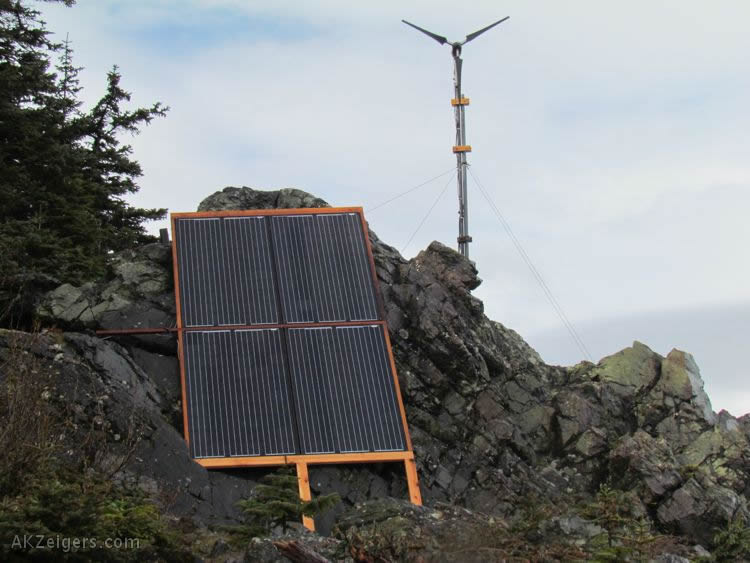
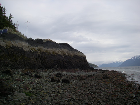
We occupy 10.62 acres of forested land with about 700 feet of ocean waterfront. The compound includes a 2-story main cabin, a 1.25 story cottage, a workshop/storage shed, chicken coop, greenhouse, smokehouse and root cellar. We have a large garden and a dual-source water system. A photovoltaic array and wind generator provide our electricity.
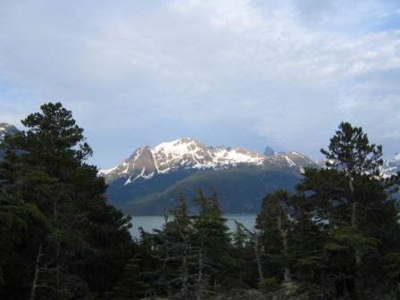
The land is south of Haines, 1.25 miles across Mud Bay, over the ridge, and down to the very edge of Lynn Canal, America's deepest and most spectacular fjord. To get to town, we hike if the tides are low enough, or canoe and kayak around the point. There's no road to the property.
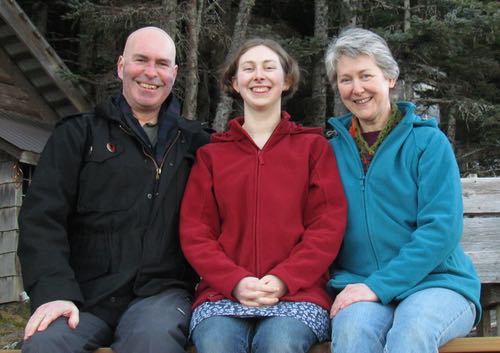
Mark, Aly, and Michelle, a portrait from 2017.
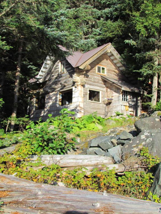
The homestead cabin. See what it looks like inside.
We bought the property in early 2005 after first seeing it December 2004. We sold our house in Juneau, Alaska, left our jobs, and moved to the property mid-August 2006. Michelle and Aly work part time for a local tour company, and Mark develops freelance Web sites and runs a micro-publishing company via Internet, but we make our living mostly through subsistence, growing and gathering as much of our own food as possible. Our daughter, Aly, was home schooled through high school.
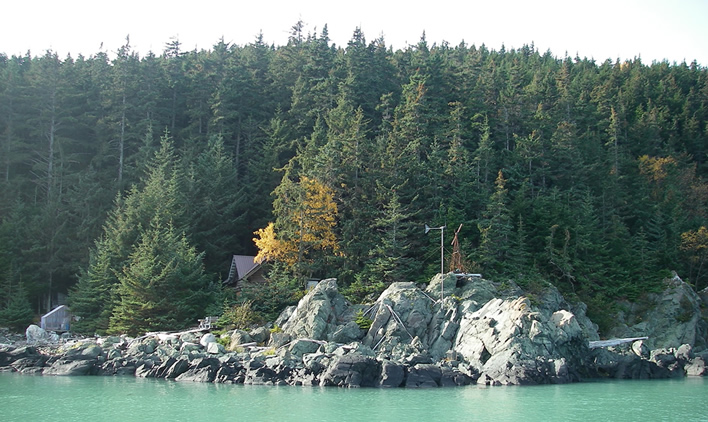
Our property includes a very rocky waterfront. Behind the cabin the property rises steeply. We have some cliffs, and a rocky knoll at the top of the ridge with a spectacular view.
The solar array and wind generator that power our homestead. This is 21st Century pioneering!
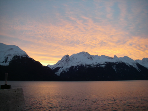
A February morning from our veranda.
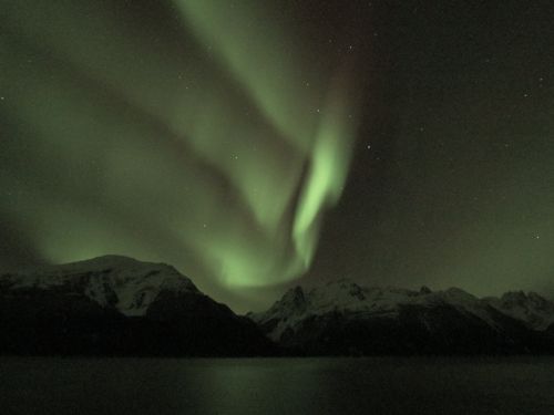
Aurora Borealis over the same view.
The view from the knoll high above the cabin
compound.
Southern edge of the property looking back.
Buildings barely appearing left to right: boathouse, greenhouse, tip of cabin
roof.
The "veranda" is just below where the tree line ends at the beach.
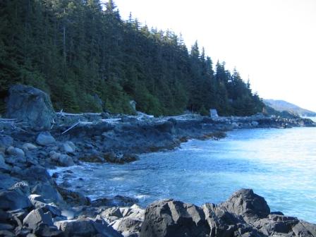
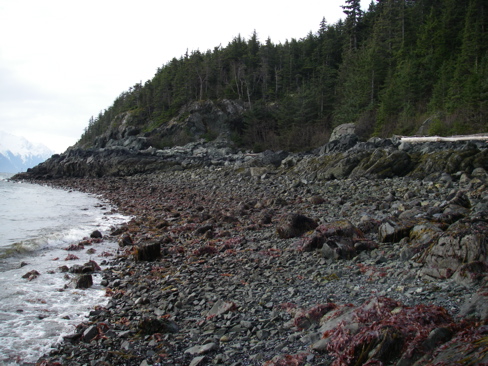
Most of our beach is cliff, about 20 feet high on the north edge, somewhat less on the south. These drop down to a shelf that's exposed at about a zero tide or less. The shelf slopes quickly downward, then at a certain point drops off into the 80 fathom depths of Lynn Canal.
Below you can see the shelf exposed looking north and looking south, at about a -4.6 foot low tide, the second lowest tide of 2008.
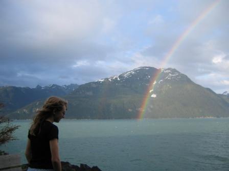
We believe we've found the
end of the rainbow!
Learn more about our life, see more photos of our homestead, and read our blog by following the links at the top of the page.
HOW CAN I SUPPORT THIS SITE? The information on this site is free to you, but not to us. Our cellular based Internet connection costs a good percentage of our total monthly income. The best way to support us is to become a Patron on our Patreon Page. That way, you get stuff for your contribution! Also, we earn revenue through purchases from our Store, ad links on each page, and Amazon.com pays us a commission on purchases from their site if you enter through our links on the Book List Page or on the blog. This applies whether or not you purchase one of our selected titles. |
|---|
©2019 Mark A. Zeiger