
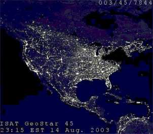
A satellite image of the northeastern U.S. taken by the Defense Meteorological Satellite Program on Aug. 14, 2003 at 9:03 p.m., when a blackout affected 50 million people. (Image: NOAA/DMSP.)
A satellite image of the northeastern U.S. taken by the Defense Meteorological Satellite Program on Aug. 14, 2003 at 9:03 p.m., when a blackout affected 50 million people. (Image: NOAA/DMSP.)